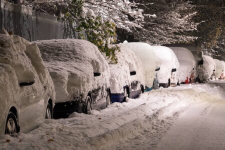
As the Midwest and Northeast recover from consecutive winter storms, a new wave of powerful systems is brewing, ready to unleash heavy snow and freezing rain across vast stretches of the country. Forecast models indicate that multiple rounds of wintry weather will impact the central U.S. and the East Coast throughout the week.
A Surge of Snow and Ice on the Horizon
Frigid air remains entrenched across the northern states, setting the stage for a widespread snow and ice event. The first storm is expected to develop over the central U.S. on Monday night, strengthening as it moves eastward. By Tuesday and Wednesday, snow and freezing rain will affect areas from the Appalachian Mountains to the mid-Atlantic and parts of the Northeast.
The most significant ice accumulations—over 0.25 inches—are projected for regions spanning northwestern North Carolina to southwestern Virginia. This could lead to fallen tree limbs, power outages, and hazardous travel conditions. Snowfall is anticipated along the I-95 corridor from Richmond to Philadelphia, including Washington, D.C., where 4-6 inches of snow is expected.
Another Storm Quickly Follows
Right on the heels of the first system, a second storm is set to intensify over the Central Plains from Tuesday evening into Wednesday. Heavy snow is likely for cities such as Kansas City, while Oklahoma City and Springfield, Missouri, may see accumulating ice.
Winter storm watches are already in effect for northern Kansas and Missouri from Wednesday through Thursday. Snowfall totals along the I-70 corridor could surpass 5 inches, with Kansas City potentially receiving 4-8 inches. The storm will then shift toward the Great Lakes, bringing snow to Chicago and St. Louis. Meanwhile, major Northeast cities are likely to see rainfall rather than snow with this system.
Kansas Governor Laura Kelly has declared a state of disaster emergency in anticipation of the severe weather, urging residents to prepare emergency kits and contingency plans.
Winter Weather Impacts on Major Cities
Below-average temperatures are forecasted for much of the continental U.S. in the coming weeks. This prolonged cold snap, coupled with frequent winter storms, could lead to ongoing disruptions. Here’s how the approaching Winter storms may impact key locations:
- Oklahoma City: Up to 0.25 inches of ice accumulation expected late Tuesday into Wednesday morning.
- Kansas City: A winter storm watch is in effect from Tuesday night through Wednesday, with 4-8 inches of snow possible.
- St. Louis: Snowfall of 1-3 inches expected on Wednesday afternoon.
- Chicago: Snow will begin Wednesday and persist into Thursday, accumulating over an inch.
- Washington, D.C.: Snowfall of 4-6 inches expected Tuesday afternoon into early Wednesday.
- Philadelphia: Anticipated snowfall of 2-4 inches from Tuesday afternoon through Wednesday.
- New York City: A light snow event, with 1-2 inches possible Tuesday night.
A Third Storm Targets the West Coast
By midweek, yet another storm is projected to hit the West Coast, bringing heavy rainfall to Southern California on Thursday. In areas like Ventura County, significant downpours could trigger flash flooding and dangerous debris flows, particularly in regions scarred by recent wildfires. Over 34 million people across Central and Southern California, including Sacramento, Los Angeles, and the San Francisco Bay Area, are under a heightened risk for excessive rainfall.
An Active Winter Pattern Continues
As the weekend approaches, meteorologists anticipate additional storm activity moving eastward. A lingering Arctic air mass is expected to push temperatures 10 to 20 degrees below normal across the Northeast. The current jet stream pattern is acting as a conveyor belt, steering storm after storm across the northern U.S., a trend likely to persist into mid-February.
With an exceptionally active storm season underway, forecasters urge residents across affected regions to stay informed, prepare for travel disruptions, and exercise caution during hazardous conditions. The relentless winter of 2025 shows no signs of letting up anytime soon.
Did you like it? 4.5/5 (26)


